Alto Orinoco Municipality (Municipio Autónomo Alto Orinoco)
After the dissolution of the Spanish Commission of Territorial Limits by order of the Crown in 1760, Iturriaga and Solano returned to Spain and presented to the Court a series of proposals to ensure Spanish control over their possessions of Orinoco and Río Negro. Out of these proposals came the decision to create separate commands. On March 17, 1767, Diez de la Fuente arrived in Esmeralda accompanied by 60 Spaniards and the caciques Wadena and Wasaha, who led a group of 3,000 natives. With this, the redevelopment of Esmeralda commenced.
The municipality is recognized as a territorial division by the government of Antonio Guzmán Blanco on December 10, 1880, of what is now the Amazonas State.
Map - Alto Orinoco Municipality (Municipio Autónomo Alto Orinoco)
Map


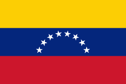
Country - Venezuela

Currency / Language
| ISO | Currency | Symbol | Significant figures |
|---|---|---|---|
| VES | Venezuelan bolÃvar | BsS. or Bs. | 2 |
| ISO | Language |
|---|---|
| ES | Spanish language |